UN
270 Derby Road
£ 187,000
Description
We don't have a Description for this property.
- Bedrooms
- 2
- Bathrooms
- 0


Leaflet © OpenStreetMap contributors
The heatmap indicates the level of crime in the area. The color of the heatmap indicates the crime severity and recency.
Metrics Year-on-Year
- Average area value
- 222,105.00 £Increased by 27.39 %
- Average area rental value
- 751.00 £/moDecreased by 24.90 %
- Est rental Yield
- 4.06 %Decreased by 40.99 %
- Crime Rate
- 2.00 %Unchanged by 0.00 %
from 174,349.00 £
from 1,000.00 £/mo
from 6.88 %
from 2.00 %
Nearby Schools
| Name | Type | Ofsted | Distance |
|---|---|---|---|
| Moorfield Primary School | Community School | Good | 0.45 KM |
| Brookfields School | Academy Special Converter | 1.13 KM | |
| St John Fisher Catholic Primary School | Voluntary Aided School | Good | 1.53 KM |
| Aspiring Foundations Federated Nursery Schools - Warrington Road Nursery School | Local Authority Nursery School | Outstanding | 1.78 KM |
| Warrington Road Children'S Centre | Children's Centre | 1.84 KM |
Images
Nearby Streets
| Name | Average Price | Average Sqft | Distance |
|---|---|---|---|
| Barrow's Green Lane | £ 0 | 0 | 0.00 KM |
| School Way | £ 0 | 0 | 0.00 KM |
| Nursery Close | £ 215,000 | 0 | 0.00 KM |
| Daffodil Close | £ 0 | 0 | 0.00 KM |
| Honeyspot Crescent | £ 360,000 | 0 | 0.00 KM |
Nearby Transport
| Name | NLC | TLC | Distance |
|---|---|---|---|
| Widnes | 2391 | WID | 2.90 KM |
| Lea Green | 2339 | LEG | 4.96 KM |
| St Helens Junction | 2340 | SHJ | 5.45 KM |
| Runcorn | 2291 | RUN | 6.22 KM |
| Sankey For Penketh | 2388 | SNK | 6.44 KM |
Nearby Listings
| Address | Price | Type | Score | Distance |
|---|---|---|---|---|
| Derby Road, Widnes | £ 325,000 | BUY | Unknown | 0.01 KM |
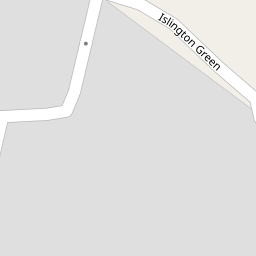
| Islington Green, Widnes, WA8 3EG | £ 345,000 | BUY | 8 / 10 | 0.20 KM |
| Derby Road, Widnes, WA8 | £ 500,000 | BUY | 7 / 10 | 0.21 KM |
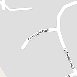
| Cedardale Park, Widnes, WA8 | £ 450,000 | BUY | 7 / 10 | 0.23 KM |
| Bermondsey Grove, Widnes | £ 400,000 | BUY | Unknown | 0.25 KM |
Nearby Properties
| Address | Price | Distance |
|---|---|---|
| 222 Derby Road | £ 135,000 | 0.00 KM |
| 270 Derby Road | £ 187,000 | 0.00 KM |
| 252 Derby Road | £ 186,000 | 0.00 KM |
| 244 Derby Road | £ 50,000 | 0.00 KM |
| 276 Derby Road | £ 249,950 | 0.00 KM |